
File:ISS059-E-113878 - View of Iran, Shatt al-Arab wetlands, Shadegan Wildlife Peninsula, Abadan Island, Persian Gulf (cropped).jpg

Size of this preview: 722 × 599 pixels. Other resolutions: 289 × 240 pixels | 578 × 480 pixels | 925 × 768 pixels | 1,233 × 1,024 pixels | 2,467 × 2,048 pixels | 2,775 × 2,304 pixels.
Original file (2,775 × 2,304 pixels, file size: 1.56 MB, MIME type: image/jpeg)
| This is a file from the Wikimedia Commons. Information from its description page there is shown below. Commons is a freely licensed media file repository. You can help. |
Summary
| Description |
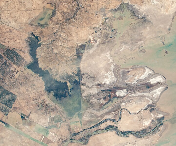
English: View of Iran taken during ISS Expedition 59. Shatt al-Arab, Abadan Island, Bahmanshir, Shadegan Wildlife Refuge, Shadegan town region, Shadegan Pond, floods, road dam, dry river beds, wetlands, Sar Bandar, Persian Gulf. |
| Date | |
| Source | JSC Gateway to Astronaut Photography of Earth |
| Author | Earth Science and Remote Sensing Unit, NASA Johnson Space Center |
| Other versions | |
| Sun Azimuth | 274° |
| Sun Elevatation | 43° |
| Altitude | 220 nautical miles (410 km) |
| Mission | ISS059 |
| Roll | E |
| Frame | 113878 |
| Camera | NIKON D5 S/N: 3502461 |
| Focal length | 65 mm |
.jpg)

.jpg)
| Camera location | | View this and other nearby images on: OpenStreetMap |
|---|
.jpg¶ms=031.700000_N_0048.600000_E_globe:Earth_type:camera__&language=en)
This image or video was catalogued by Johnson Space Center of the United States National Aeronautics and Space Administration (NASA) under Photo ID: ISS059-E-113878. This tag does not indicate the copyright status of the attached work. A normal copyright tag is still required. See Commons:Licensing. Other languages:
|
Licensing
| This file is in the public domain in the United States because it was solely created by NASA. NASA copyright policy states that "NASA material is not protected by copyright unless noted". (See Template:PD-USGov, NASA copyright policy page or JPL Image Use Policy.) | ||
 |
Warnings:
|
| Annotations | This image is annotated: View the annotations at Commons |
File history
Click on a date/time to view the file as it appeared at that time.
| Date/Time | Thumbnail | Dimensions | User | Comment | |
|---|---|---|---|---|---|
| current | 21:18, 18 May 2024 | | 2,775 × 2,304 (1.56 MB) | LudwigSebastianMicheler | File:ISS059-E-113878 - View of Iran and Iraq, Shatt al-Arab, Basra, Abadan Island, Persian Gulf, Karun river, Ahwaz (cropped).jpg cropped 24 % horizontally, 33 % vertically, 49 % areawise using CropTool with precise mode. |
.jpg)
File usage
The following pages on the English Wikipedia use this file (pages on other projects are not listed):
.jpg)