Wikipedia portal for content related to Myanmar (Burma)
ကြိုဆိုပါတယ်။ / Welcome to the Myanmar Portal
Myanmar, officially the Republic of the Union of Myanmar and also known as Burma (the official name until 1989), is a country in Southeast Asia. It is the largest country by area in Mainland Southeast Asia and has a population of about 55 million. It is bordered by Bangladesh and India to its northwest, China to its northeast, Laos and Thailand to its east and southeast, and the Andaman Sea and the Bay of Bengal to its south and southwest. The country's capital city is Naypyidaw, and its largest city is Yangon (formerly Rangoon).
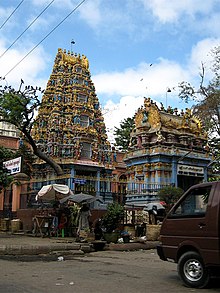
Shri Kali Temple, Burma, a Hindu temple with Dravidian architecture in YangonBurmese Indians are a group of people of Indian origin who live in Myanmar (Burma). The term 'Burmese Indian' refers to a broad range of people from South Asia, most notably from present-day countries such as India and Bangladesh. While Indians have lived in Burma for many centuries, most of the ancestors of the current Burmese Indian community emigrated to Burma from the start of British rule in the mid-19th century to the separation of British Burma from British India in 1937. During colonial times, ethnic Indians formed the backbone of the government and economy serving as soldiers, civil servants, merchants, moneylenders, mobile laborers and dock workers. A series of anti-Indian riots in the 1930s and mass emigration at the onset of the Japanese invasion of Burma in 1942 were followed in the 1960s by the forced migration of hundreds of thousands of ethnic Indians, exacerbated by internal conflict in Myanmar.
Burmese Indians today are estimated to account for approximately 5% (about 2.0–2.5 million people) of the population of Burma and are concentrated largely in the two major cities (Yangon and Mandalay) and former colonial towns (Pyin U Lwin and Kalaw). They wield considerable influence and control over the Burmese economy and have a major socio-cultural presence within the country. Amongst the well-known Burmese Indians is S N Goenka, a leading practitioner and teacher of vipassanā meditation and Helen, a well-known Bollywood film actress who is also of Anglo-Burmese descent. (Full article...)
Image 3
Inle Lake (Burmese: အင်းလေးကန်; MLCTS: ang: le: kan, [ʔɪ́ɰ̃lékàɰ̃]), a freshwaterlake located in the Nyaungshwe Township of Shan State, part of Shan Hills in Myanmar (Burma). It is the second largest lake in Myanmar, with an estimated surface area of 44.9 square miles (116 km2), and one of the highest at an elevation of 2,900 feet (880 m). During the dry season, the average water depth is 7 feet (2.1 m), with the deepest point being 12 feet (3.7 m). During the rainy season, this can increase by 5 feet (1.5 m).
The watershed area for the lake lies to a large extent to the north and west of the lake. The lake drains through the Nam Pilu or Balu Chaung on its southern end. There is also a hot spring on its northwestern shore. (Full article...)
The Burma Railway, also known as the Siam–Burma Railway, Thai–Burma Railway and similar names, or as the Death Railway, is a 415 km (258 mi) railway between Ban Pong, Thailand, and Thanbyuzayat, Burma (now called Myanmar). It was built from 1940 to 1943 by South East Asian civilians abducted and forced to work by the Japanese and a smaller group of captured Allied soldiers, to supply troops and weapons in the Burma campaign of World War II. It completed the rail link between Bangkok, Thailand, and Rangoon, Burma. The name used by the Japanese Government was Tai–Men Rensetsu Tetsudō (泰緬連接鉄道), which means Thailand-Burma-Link-Railway.
At least 250,000 Southeast Asian civilians were subjected to forced labour to ensure the construction of the Death Railway and more than 90,000 civilians died building it, as did around 12,000 Allied soldiers. The workers on the Thai side of the railway were Tamils, Malays, and fewer Chinese civilians from Malaya. Possibly over 345,000 died while working, with the death rate per month rivaling that of Auschwitz. (Full article...)
Image 5
Nandar Hlaing (Burmese: နန္ဒာလှိုင်; also spelt Nanda Hlaing) is a Burmese film actress of Mon descent. She was one of the leading actresses of Myanmar from mid 90s to mid 2000s. She won the 1998 Myanmar Motion Picture Academy Awards for best supporting actress for her performance in Shwe Natha San-Ein. She also won the 2006 Academy Award for best actress.
In January 2012, Nandar Hlaing's company, Mahar Nandar Trading Company, became the exclusive authorized retailer of Missha cosmetics within Myanmar. (Full article...)
Image 6
Violent clashes have been ongoing in the northern part of Myanmar's Rakhine State since October 2016. Insurgent attacks by the Arakan Rohingya Salvation Army (ARSA) have led to sectarian violence perpetrated by Myanmar's military and the local Buddhist population against predominantly MuslimRohingya civilians. The conflict has sparked international outcry and was described as an ethnic cleansing by the United Nations High Commissioner for Human Rights. In August 2017, the situation worsened and hundreds of thousands of refugees fled Myanmar into Bangladesh, with an estimated 500,000 refugees having arrived by 27 September 2017. In January 2019, Arakan Army insurgents raided border police posts in Buthidaung Township, joining the conflict and beginning their military campaign in northern Rakhine State against the Burmese military.
Portrait of the Thirty Comrades The Thirty Comrades (Burmese: ရဲဘော်သုံးကျိပ်) constituted the embryo of the modern Burmese army called the Burma Independence Army (BIA) which was formed to fight for independence from Britain. This was accomplished just before the majority of the Thirty Comrades returned with the invading Japanese Army initially through Southern Burma in December 1941.
In April 1941, small groups of Burmese youth left Burma secretly to obtain military training to fight the British colonists in the struggle for independence. Their leader was Thakin Aung San and they were sent by the Dobama Asiayone ("We Burmans Association") with the intention to get assistance from Guangzhou. By a quirk of fate, however, they ran into the Japanese instead in Amoy and arrived in Japan later to be flown to occupied parts of Sanya, in order to receive military training from the Japanese Army. They were later moved to Formosa for security reasons and subsequently returned to Burma via Vietnam and Thailand with the Japanese. On 26 December 1941, in a house (owned by a Burmese doctor) in Bangkok, about 25 of the Thirty Comrades had their blood drawn from their arms in syringes, then poured into a silver bowl from which each of them drank – thway thauk in time-honoured Burmese military tradition – pledging "eternal loyalty" among themselves and to the cause of Burmese independence. Their average age was just 24 years. A Japanese officer called Suzuki Keiji, better known among the Burmese by his nom de guerre Bo Mogyo (Commander Thunderbolt) and head of a special intelligence unit called Minami Kikan (南機関) formed in order to support a national uprising in Burma, was the mentor and principal trainer of the Thirty Comrades. The British were driven out of Burma to India during World War II. (Full article...)
The sun bear (Helarctos malayanus) is a species in the familyUrsidae (the only species in the genus Helarctos) occurring in the tropical forests of Southeast Asia. It is the smallest bear species, standing nearly 70 cm (28 in) at the shoulder and weighing 25–65 kg (55–143 lb). It is stockily built, with large paws, strongly curved claws, small, rounded ears and a short snout. The fur is generally short and jet black, but can vary from grey to red. The sun bear gets its name from its characteristic orange to cream-coloured chest patch. Its unique morphology—inward-turned front feet, flattened chest, powerful forelimbs with large claws—suggests adaptations for climbing.
The most arboreal (tree-living) of all bears, the sun bear is an excellent climber and sunbathes or sleeps in trees 2 to 7 m (7 to 23 ft) above the ground. It is mainly active during the day, though nocturnality might be more common in areas frequented by humans. Sun bears tend to remain solitary, but sometimes occur in twos (such as a mother and her cub). They do not seem to hibernate, possibly because food resources are available the whole year throughout the range. Being omnivores, sun bears' diet includes ants, bees, beetles, honey, termites, and plant material such as seeds and several kinds of fruits; vertebrates such as birds and deer are also eaten occasionally. They breed throughout the year; individuals become sexually mature at two to four years of age. Litters comprise one or two cubs that remain with their mother for around three years. (Full article...)
Traditionally, the sea has been used for fishery and transportation of goods between the coastal countries and its coral reefs and islands are popular tourist destinations. The fishery and tourist infrastructure was severely damaged by the December 2004 Indian Ocean earthquake and tsunami. (Full article...)
Image 10
The military history of Myanmar (Burma) spans over a millennium, and is one of the main factors that have shaped the history of the country, and to a certain degree, the history of Southeast Asia. At various times in history, successive Burmese kingdoms were also involved in warfare against their neighbouring states in the surrounding regions of modern Burmese borders—from Bengal, Manipur and Assam in the west, to Yunnan (the southern China) in the northeast, to Laos and Siam in the east and southeast.
The Royal Burmese Army was a major Southeast Asian armed force between the 11th and 13th centuries and between 16th and 19th centuries. It was the premier military force in the 16th century when the Toungoo dynasty built the largest empire in the history of Southeast Asia. The centuries-long warfare between Burma and Siam (1547–1855) shaped not only the history of both countries but also that of mainland Southeast Asia. In the 18th and early 19th centuries, highly militaristic Konbaung kings had built the largest empire in mainland Southeast Asia until they encountered the British in present-day northeast India. Prior to the three Anglo-Burmese wars (1824–1885), previous existential threats to the country had come from China in the form of Mongol invasions (1277–1301) and Manchu invasions (1765–1769). (Full article...)
... that the Myanmar Photo Archive(example photograph shown) revealed "a side of modern Myanmar that, until very recently, remained hidden in dusty attics"?
Image 2Pagan Kingdom during Narapatisithu's reign. Burmese chronicles also claim Kengtung and Chiang Mai. Core areas shown in darker yellow. Peripheral areas in light yellow. Pagan incorporated key ports of Lower Burma into its core administration by the 13th century. (from History of Myanmar)
Image 8British soldiers on patrol in the ruins of the Burmese town of Bahe during the advance on Mandalay, January 1945. (from History of Myanmar)
Image 9A wedding procession, with the groom and bride dressed in traditional Burmese wedding clothes, reminiscent of royal attire (from Culture of Myanmar)
Image 10Vegetable stall on the roadside at the Madras Lancer Lines, Mandalay, January 1886. Photographer: Hooper, Willoughby Wallace (1837–1912). (from History of Myanmar)
Image 11A theatrical performance of the Mon dance (from Culture of Myanmar)
Image 19British soldiers remove their shoes at the entrance of Shwedagon Pagoda. To the left, a sign reads "Foot wearing is strictly prohibited" in Burmese, English, Tamil, and Urdu. (from Culture of Myanmar)
Image 20A group of Buddhist worshipers at Shwedagon Pagoda, an important religious site for Burmese Buddhists (from Culture of Myanmar)
Image 21British soldiers dismantling cannons belonging to King Thibaw's forces, Third Anglo-Burmese War, Ava, 27 November 1885. Photographer: Hooper, Willoughby Wallace (1837–1912). (from History of Myanmar)
Image 33Myanmar (Burma) map of Köppen climate classification (from Geography of Myanmar)
Image 34The paddle steamer Ramapoora (right) of the British India Steam Navigation Company on the Rangoon river having just arrived from Moulmein. 1895. Photographers: Watts and Skeen (from History of Myanmar)


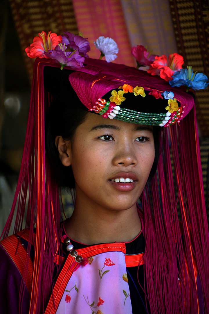
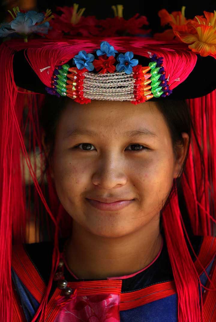
![Image 1 The Lisu people (Lisu: ꓡꓲ‐ꓢꓴ ꓫꓵꓽ; Burmese: လီဆူလူမျိုး, [lìsʰù]; Chinese: 傈僳族; pinyin: Lìsùzú; Thai: ลีสู่) are a Tibeto-Burman ethnic group who inhabit mountainous regions of Myanmar (Burma), southwest China, Thailand, and the Indian state of Arunachal Pradesh. About 730,000 Lisu live in Lijiang, Baoshan, Nujiang, Dêqên and Dehong prefectures in Yunnan Province and Sichuan Province, China. The Lisu form one of the 56 ethnic groups officially recognized by China. In Myanmar, the Lisu are recognized as one of 135 ethnic groups and an estimated population of 600,000. Lisu live in the north of the country; Kachin State (Putao, Myitkyina, Danai, Waingmaw, Bhamo), Shan State (Momeik, Namhsan, Lashio, Hopang, and Kokang) and southern Shan State (Namsang, Loilem, Mongton), and Sagaing Division (Katha and Khamti), Mandalay Division (Mogok and Pyin Oo Lwin). Approximately 55,000 live in Thailand, where they are one of the six main hill tribes. They mainly inhabit remote mountainous areas. (Full article...)](//upload.wikimedia.org/wikipedia/en/d/d2/Blank.png)


![Image 1 The Lisu people (Lisu: ꓡꓲ‐ꓢꓴ ꓫꓵꓽ; Burmese: လီဆူလူမျိုး, [lìsʰù]; Chinese: 傈僳族; pinyin: Lìsùzú; Thai: ลีสู่) are a Tibeto-Burman ethnic group who inhabit mountainous regions of Myanmar (Burma), southwest China, Thailand, and the Indian state of Arunachal Pradesh. About 730,000 Lisu live in Lijiang, Baoshan, Nujiang, Dêqên and Dehong prefectures in Yunnan Province and Sichuan Province, China. The Lisu form one of the 56 ethnic groups officially recognized by China. In Myanmar, the Lisu are recognized as one of 135 ethnic groups and an estimated population of 600,000. Lisu live in the north of the country; Kachin State (Putao, Myitkyina, Danai, Waingmaw, Bhamo), Shan State (Momeik, Namhsan, Lashio, Hopang, and Kokang) and southern Shan State (Namsang, Loilem, Mongton), and Sagaing Division (Katha and Khamti), Mandalay Division (Mogok and Pyin Oo Lwin). Approximately 55,000 live in Thailand, where they are one of the six main hill tribes. They mainly inhabit remote mountainous areas. (Full article...)](/wiki/File:Blank.png)


.jpg)


 Former US President Barack Obama poses barefoot on the grounds of Shwedagon Pagoda, one of Myanmar's major Buddhist pilgrimage sites. (from Culture of Myanmar)
 Pagan Kingdom during Narapatisithu's reign. Burmese chronicles also claim Kengtung and Chiang Mai. Core areas shown in darker yellow. Peripheral areas in light yellow. Pagan incorporated key ports of Lower Burma into its core administration by the 13th century. (from History of Myanmar)
 Myinhkin thabin - equestrian sport (from Culture of Myanmar)
 Aung San Suu Kyi addresses crowds at the NLD headquarters shortly after her release. (from History of Myanmar)
 Hlei pyaingbwè - a Burmese regatta (from Culture of Myanmar)
 Temples at Mrauk U, was the capital of the Mrauk U Kingdom, which ruled over what is now Rakhine State. (from History of Myanmar)
 Aerial view of a burned Rohingya village in Rakhine state, Myanmar, September 2017 (from History of Myanmar)
 British soldiers on patrol in the ruins of the Burmese town of Bahe during the advance on Mandalay, January 1945. (from History of Myanmar)
 A wedding procession, with the groom and bride dressed in traditional Burmese wedding clothes, reminiscent of royal attire (from Culture of Myanmar)
 Vegetable stall on the roadside at the Madras Lancer Lines, Mandalay, January 1886. Photographer: Hooper, Willoughby Wallace (1837–1912). (from History of Myanmar)
 A theatrical performance of the Mon dance (from Culture of Myanmar)
 Sculpture of Myanmar mythical lion (from Culture of Myanmar)
 Protesters in Yangon with a banner that reads non-violence: national movement in Burmese, in the background is Shwedagon Pagoda. (from History of Myanmar)
 A bull fight, 19th-century watercolour (from Culture of Myanmar)
 Boxing match, 19th-century watercolour (from Culture of Myanmar)
 Mountains near Pindaya on the Shan Plateau (from Geography of Myanmar)
 The restored Taungoo or Nyaungyan dynasty c. 1650 CE. (from History of Myanmar)
 British soldiers remove their shoes at the entrance of Shwedagon Pagoda. To the left, a sign reads "Foot wearing is strictly prohibited" in Burmese, English, Tamil, and Urdu. (from Culture of Myanmar)
 A group of Buddhist worshipers at Shwedagon Pagoda, an important religious site for Burmese Buddhists (from Culture of Myanmar)
 British soldiers dismantling cannons belonging to King Thibaw's forces, Third Anglo-Burmese War, Ava, 27 November 1885. Photographer: Hooper, Willoughby Wallace (1837–1912). (from History of Myanmar)
 A large fracture on the Mingun Pahtodawgyi caused by the 1839 Ava earthquake. (from Geography of Myanmar)
 Political Map of Burma (Myanmar) c. 1450 CE. (from History of Myanmar)
 Portuguese ruler and soldiers mounting an Elephant. Philips, Jan Caspar (draughtsman and engraver) (from History of Myanmar)
 19th-century funeral cart and spire, which would form part of the procession from the home to the place of cremation (from Culture of Myanmar)
 Mount Popa, a dormant volcano in the Central Lowlands (from Geography of Myanmar)
 Jade Mine in Hpakant (from Geography of Myanmar)
 Saint Mary's Cathedral in Downtown Yangon is the largest Roman Catholic cathedral in Burma. (from Culture of Myanmar)
 Recorder's Court on Sule Pagoda Road, with the Sule Pagoda at the far end, Rangoon, 1868. Photographer: J. Jackson. (from History of Myanmar)
 The shores of Irrawaddy River at Nyaung-U, Bagan (from Geography of Myanmar)
 A wide range of Burmese lacquerware from Bagan (from Culture of Myanmar)
 Myanmar (Burma) map of Köppen climate classification (from Geography of Myanmar)
 The paddle steamer Ramapoora (right) of the British India Steam Navigation Company on the Rangoon river having just arrived from Moulmein. 1895. Photographers: Watts and Skeen (from History of Myanmar)
 Grandfather Island, Dawei (from Geography of Myanmar)
 Protesters in Yangon carrying signs reading "Free Daw Aung San Suu Kyi" on 8 February 2021. (from History of Myanmar)
 Salween river at Mae Sam Laep on the Thai-Myanmar border (from Geography of Myanmar)
 Two female musicians play the saung at a performance in Mandalay. (from Culture of Myanmar)


_headquarter.jpg)


 Commons
 Wikibooks
 Wikidata
 Wikinews
 Wikiquote
 Wikisource
 Wikiversity
 Wikivoyage
 Wiktionary


